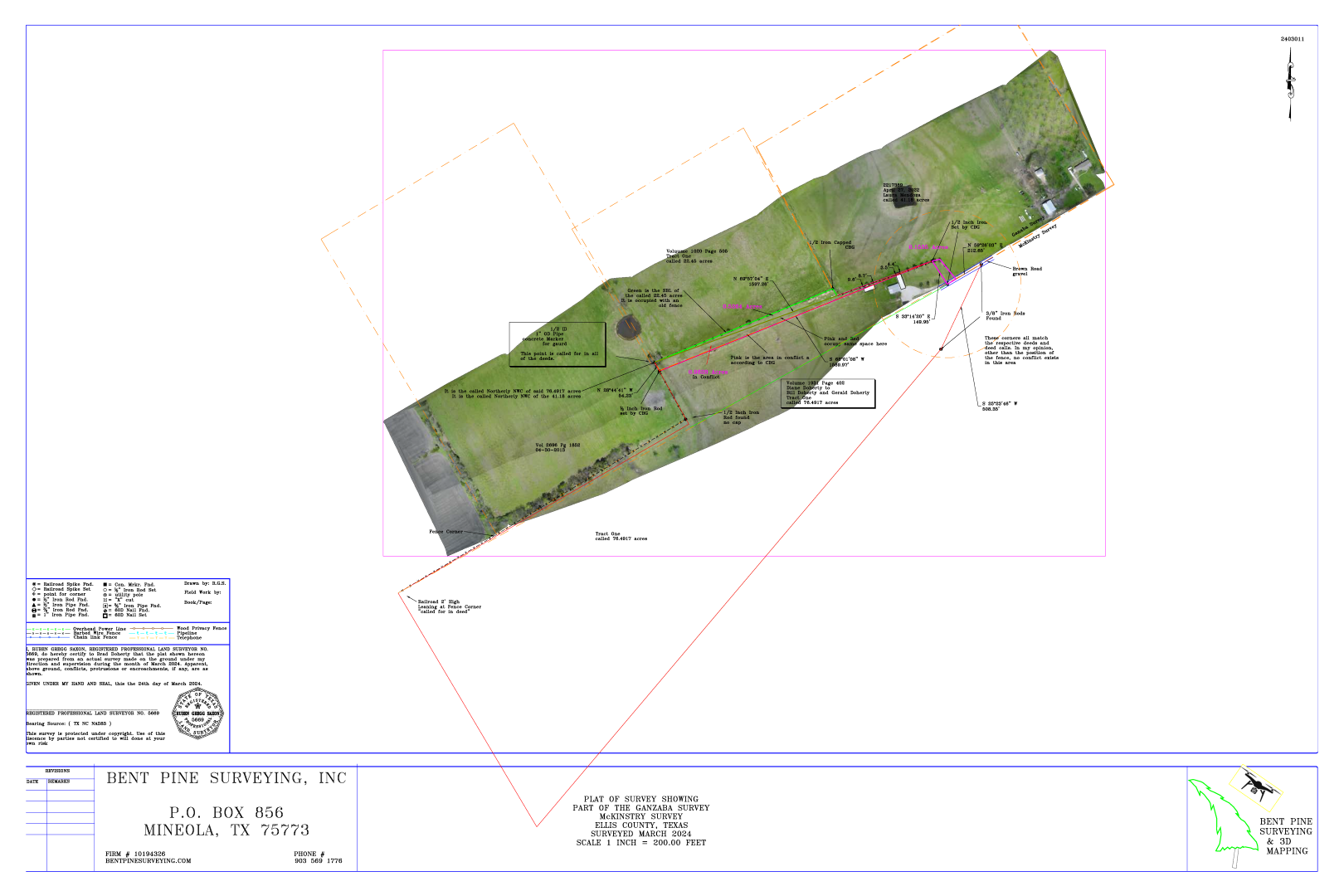
Drone Mapping
Lidar and Aerial Drone Mapping
LiDAR uses light energy and sophisticated lasers to scan and measure a target from a distance to produce a 3D model.


Drone Specs
| Specification | Value |
|---|---|
| Data Collection | LiDAR + Imagery |
| Laser Scanner | Hesai Pandar XT32M1X |
| LiDAR Beams/Returns | 32/2 |
| LiDAR Range - Usable | 80 m @ 20% reflectivity |
| Cross-track Field of View (FOV)/Combined | 120° |
| Pulse Repetition Rate | 640 kHz |
| Scanner Performance |
Precision:
5 mm
Accuracy: 20 mm |
| GNSS/INS Performance |
Position:
20-50 mm
Angle: 0.025 deg Roll/Pitch, 0.08 deg Heading |
| System Performance |
Precision observed on one Strip:
Typical 20 mm, Less than 15 mm (1 sigma) observed at 75 m on Concrete
Accuracy: Typical 3 cm RMSE, better than 5cm 3D RMSE - depending on GNSS conditions, accuracy of control points and coordinate system |
| Camera Sensor | Dual 1" mechanical shutter cameras, hardware mid-exposure pulse, 2x 20 MP, RGB |
Drone Surveying Example